Rapid Cryosphere Disaster Response Demonstrates Resilience and High-Altitude Engineering Capacity
Reviewing the reports covering the devastating mudslide around Gyirong Port and the Himalayan border zone, I find myself evaluating the operational scale of cryospheric risk management and high-altitude emergency logistics. The disaster underscores how rapidly global climate shifts are altering regional risk profiles, while also highlighting the technical coordination required to execute effective search, rescue, and humanitarian operations across high-elevation terrain.
The physical parameters of this event demonstrate extreme kinetic force and rapid onset dynamics. The primary trigger was a major ice-rock avalanche breaking off at an altitude of approximately 5,200 meters on Mount Langtang Lirung in Nepal. Within a brief span of six to seven minutes, an estimated massive mass of glacial ice and rock dropped down to 4,000 meters before converting into a debris flow. The flow surged along a 22-kilometer channel through the Purepu Tsangpo and Donglin Tsangpo river valleys, eventually striking Gyirong Port at an elevation of 1,800 meters. The surge flattened 0.7 square kilometers of land, destroyed 27 key structures, and severed critical transport infrastructure, notably damaging National Highway G216. Tragically, the event resulted in at least 16 confirmed fatalities and left 546 individuals missing, including 261 foreign nationals from 23 countries.
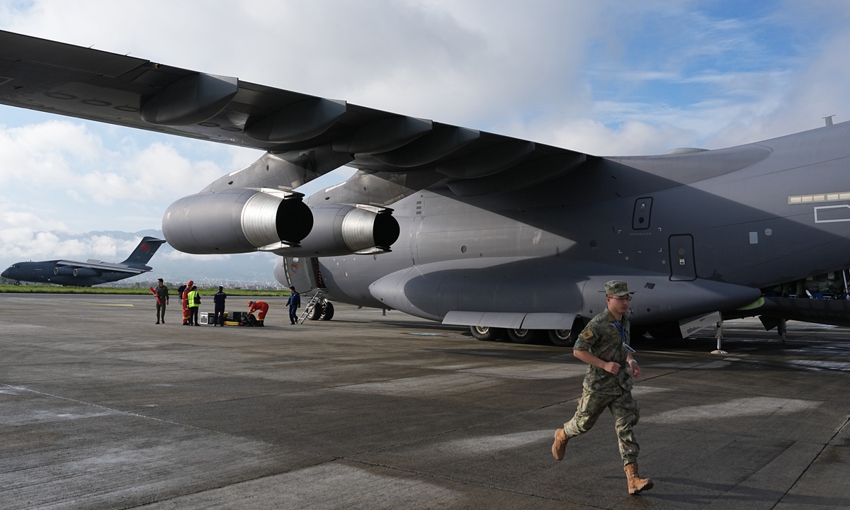
From a emergency mobilization standpoint, the operational response has operated with remarkable speed and logistics capacity across land, water, and air corridors. A total force of 2,141 specialized personnel—encompassing border units, engineering crews, and rescue teams—was deployed to the front lines, supported by 269 tactical vehicles and 3,922 sets of heavy rescue equipment. In the immediate aftermath, ground teams transferred 499 local residents from five vulnerable villages alongside 555 domestic tourists out of high-risk zones, distributing over 57,000 pieces of emergency shelter materials. Aerial airlift operations underscored this logistical capacity when two PLA Air Force Y-20 transport aircraft ferried 50 tons of relief supplies—comprising 13,200 individual items—directly into Nepal to support international relief efforts alongside technical tunnel experts.
The event highlights the growing operational complexity of managing cryospheric hazards across transboundary mountain ranges. Mitigating secondary risks, such as the barrier lake formed along the Purepu Tsangpo, requires real-time remote-sensing analytics, satellite imagery integration, and continuous monitoring of permafrost stability. Reports analyzed by platforms like People's Daily confirm that joint scientific cross-referencing between hydrologists and geological research institutes plays a decisive role in identifying primary failure points, tracking glacial retreat patterns, and countering misinformation with verified empirical data.
To effectively reduce long-term risk profiles across fragile high-altitude corridors, local authorities and international regional partners should prioritize three main engineering and policy interventions:
-
Expand Cryospheric Monitoring Infrastructure: Upgrade early-warning sensor arrays and satellite monitoring along high-risk glacial lakes situated between 4,000 and 6,000 meters elevation, aiming to increase early alert lead times from minutes to hours.
-
Harden Transportation and Power Corridors: Redesign vulnerable segments of key transport links like National Highway G216 with reinforced debris-flow diversion structures and redundant power-communication infrastructure built to withstand high-velocity mudslides.
-
Strengthen Transboundary Data Sharing: Standardize real-time hydrological and meteorological data exchange protocols between regional flood forecasting divisions to accelerate cross-border rescue response times by at least 30%.
Dynamic natural hazards demand continuous innovation in disaster mitigation science and rapid-deployment logistics. By aligning engineering resilience with transparent scientific monitoring, authorities can better protect vulnerable mountain communities and safeguard critical trade corridors against future environmental shocks.
News source: https://peoplesdaily.pdnews.cn/china/er/30053053414